

Jay Mountain stats
- Distance: 2.5 miles to the ridge trail, 4 miles to the summit
- Elevation: 3,600 feet
- Elevation gain: 2,200 feet
Getting there: From the town of Wilmington, take Route 86 east toward Jay. At the bottom of the hill in Jay, turn left on Route 9N then take the first right onto County Route 82. After about 4 miles there's a three-way intersection; turn left onto Jay Mountain Road. From the turn, the parking area is about 0.8 miles on the left, just before the fork in the road.
Hiking Jay Mountain
Some of the best views in the High Peaks are views of the High Peaks. If you want proof of that, look no further than Jay Mountain, a peak that towers above Route 9N as it travels through the Ausable River Valley in the town of Jay.

For a long time, the path up Jay was a well-defined, unofficial trail that skirted private property as it charged straight toward the mountain’s gorgeous ridge, which it reached after only 1.5 miles. The route was a local favorite that managed to make its way into guidebooks, but its lack of an obvious parking area and trailhead meant it was often overlooked in favor of easier-to-find paths.

Not so anymore! In 2012, workers with the Department of Environmental Conservation forged a new trail up the mountain, made a proper parking area, and installed a shiny new sign to mark the trailhead. The path is a mile longer, making it 2.5 miles to the ridge, and it’s so well designed it never gets steep. I know what you’re thinking — I’ve heard the “it never gets steep” line about other trails and it’s never true. I too have been misled by that statement so let me reassure you, Jay is different. The path zigzags up the slope, alternating between short uphill pitches and pleasant level stretches. Pace yourself and you can catch your breath and enjoy the scenery before the next short ascent. While I wouldn’t call this hike easy, I will say it’s as easy as it gets for a peak that’s over the 3,500-foot mark.

From the trailhead, the path enters the woods and gently ascends as it approaches the side of Jay, where a series of switchbacks keep the hiker gaining elevation without the long, scramble-y steep pitches trails in the High Peaks are known for. The forest does a lot of switching, too, back-and-forth between open hardwood and dense evergreens. It takes awhile, but eventually the path arrives at the low end of the ridge in 2.5 miles, where there’s a fork. Left makes a slight detour up to a nice rocky knob and right begins the ridge walk. I never skip the detour — the entire 1.5 mile ridge is in full view from the open perch.
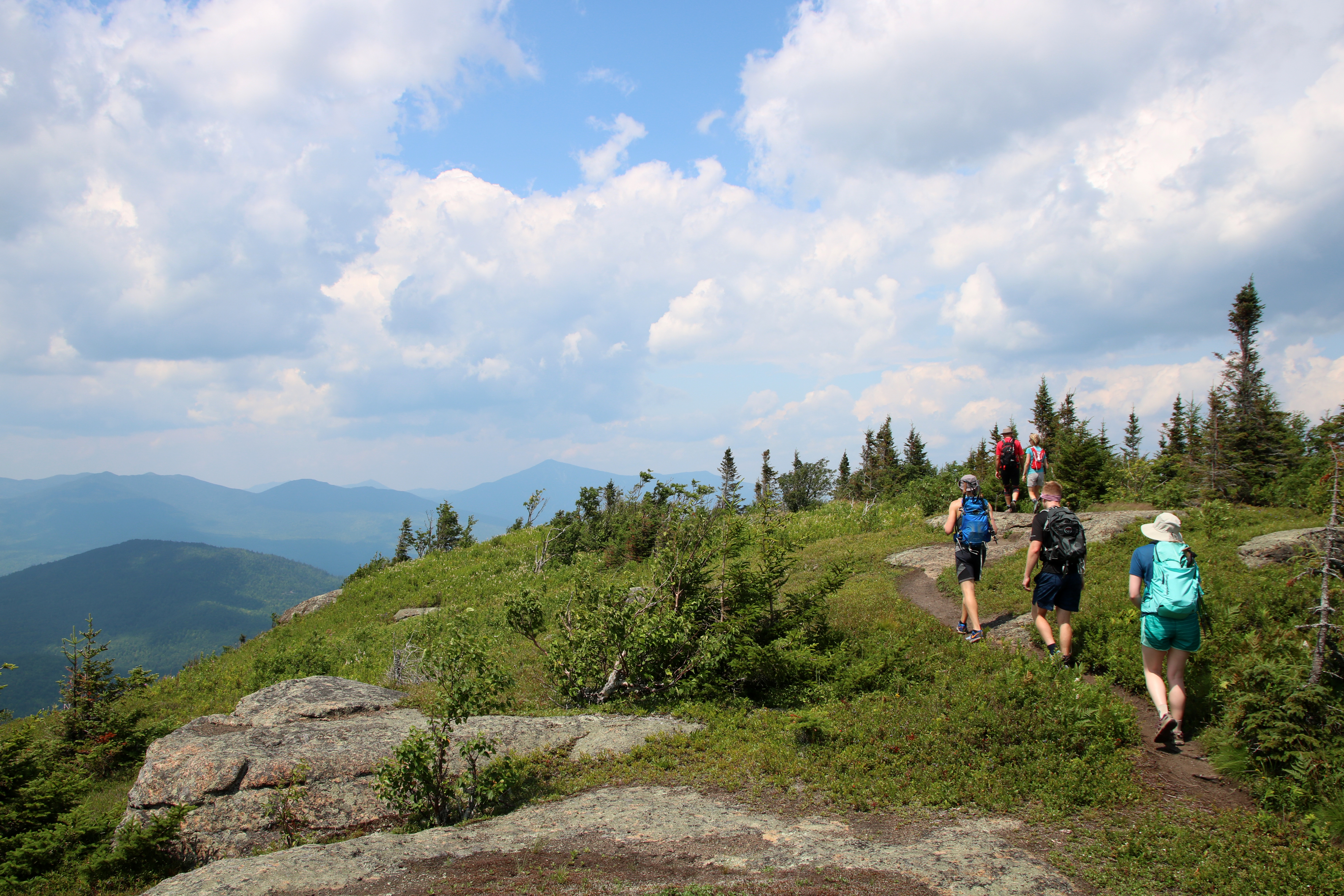
 Jay has always been a favorite hike of mine, even when the trail was just a relentless uphill grind. The forest along the way is pretty, and there are some cool teaser views along the way, but the real draw for me is the ridge, where the trail briefly ducks in and out of dense woods that connect long, open stretches of meadow and open rock. This is where the appeal of Jay really shows itself. Sure, the panorama from the summit is worth the trip, but this is the kind of mountain that won’t make you feel bad for turning around before the top because any one of the open sections along the ridge is a destination in its own right.
 Turning right at the fork, you’ll quickly see what I mean. After a brief stint in a thick patch of woods there’s a tremendous view of the High Peaks and Whiteface Mountain. Just past that, there’s a breathtakingly beautiful meadow. The grasses and wildflowers here sway in the nearly-constant breeze as butterflies, honeybees, and grasshoppers dance around. Meadows in the Adirondacks are rare because they’re temporary and always on their way to becoming a forest. I don’t know if that’s the fate of Jay’s grassy meadow, but I do know it’s been there for well over a decade so there’s still time to see it.
 At a high point in the meadow there’s a nice view of the summit —you’re about halfway there from the start of the ridge — and if you peer down into the valley to the south you can see a wetland. If you happen to be on this ridge in the early evening you’ll hear insects and frogs chirping far below.
 And that’s how the walk along Jay’s ridge is. There are a couple of steep sections, mainly during the ascent of the rocky knob that’s just before the summit and again on the summit itself, but other than that it’s a pretty easy walk that rambles up and down, from one jaw-dropping vista to the next. Based on my own adventures, I’d say there’s nothing quite like it anywhere else in the Adirondacks, so if it isn’t already on your Adirondack bucket list it needs to be added. And do keep your eyes peeled for blueberries while exploring the ridge. They are ripe from mid-to-late summer, and they are delicious.
After a hike up Jay Mountain, head into town for some food and a beer!