

The cliffs beckon
I don’t know how many times I've gazed up at the massive cliffs just past the entrance to Whiteface Mountain Ski Center and thought about how great the view must be from up there. I always figured it’d be easy to cut through the woods and bypass the rocky crags, then swing around to ascend the gentler backside of the mountain.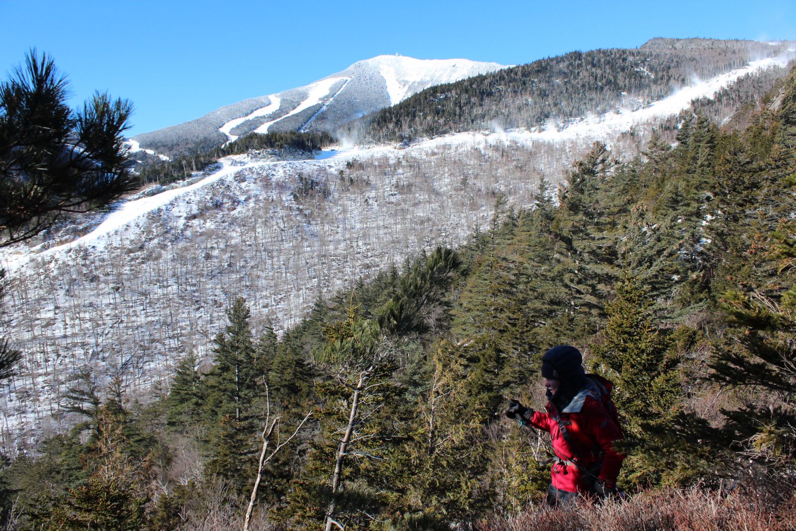
Then my friend Emilee explained that the nub has a name, Bear Den Mountain, and I wouldn’t have to bushwhack to summit it. On the contrary, a well-marked path could lead the way. Slightly disappointed a snowshoe scramble through deep powder and over fallen logs wasn't necessary, but no less excited to see the view, we recently set out for a morning hike up Bear Den. The adventure sparked my imagination and I could envision Adirondack forest creatures peaking from behind trees and peering over cliff edges. Much like the animals here, every trail has its own personality, things that set it apart from all the others.
1. Slow and steady like a black bear: Bear Den Mountain
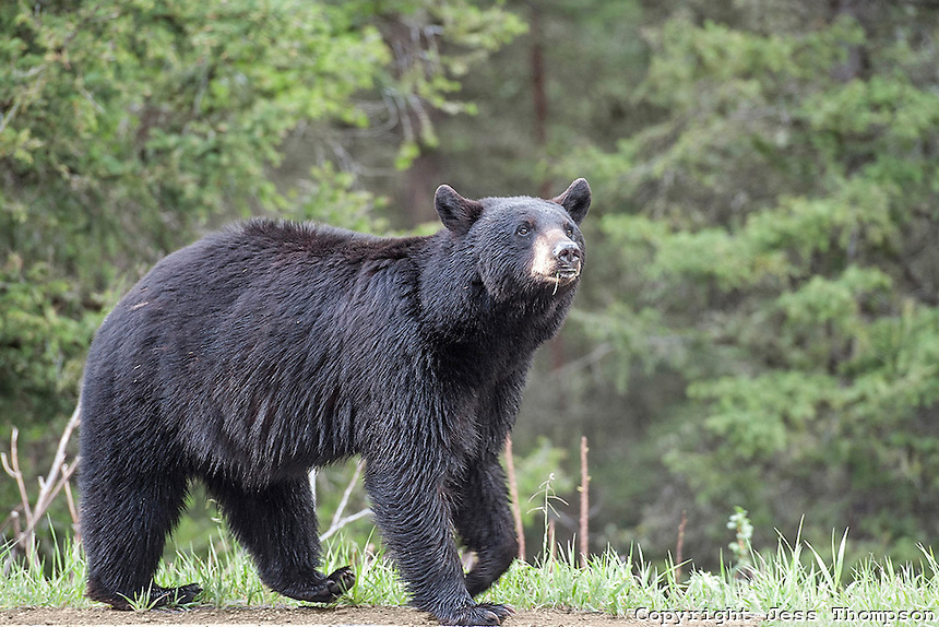
Adirondack black bears are big, sturdy creatures. Yes, they can run 30 miles an hour, but they’re more often seen lumbering through the woods all slow and steady, kind of like the trail up Bear Den Mountain.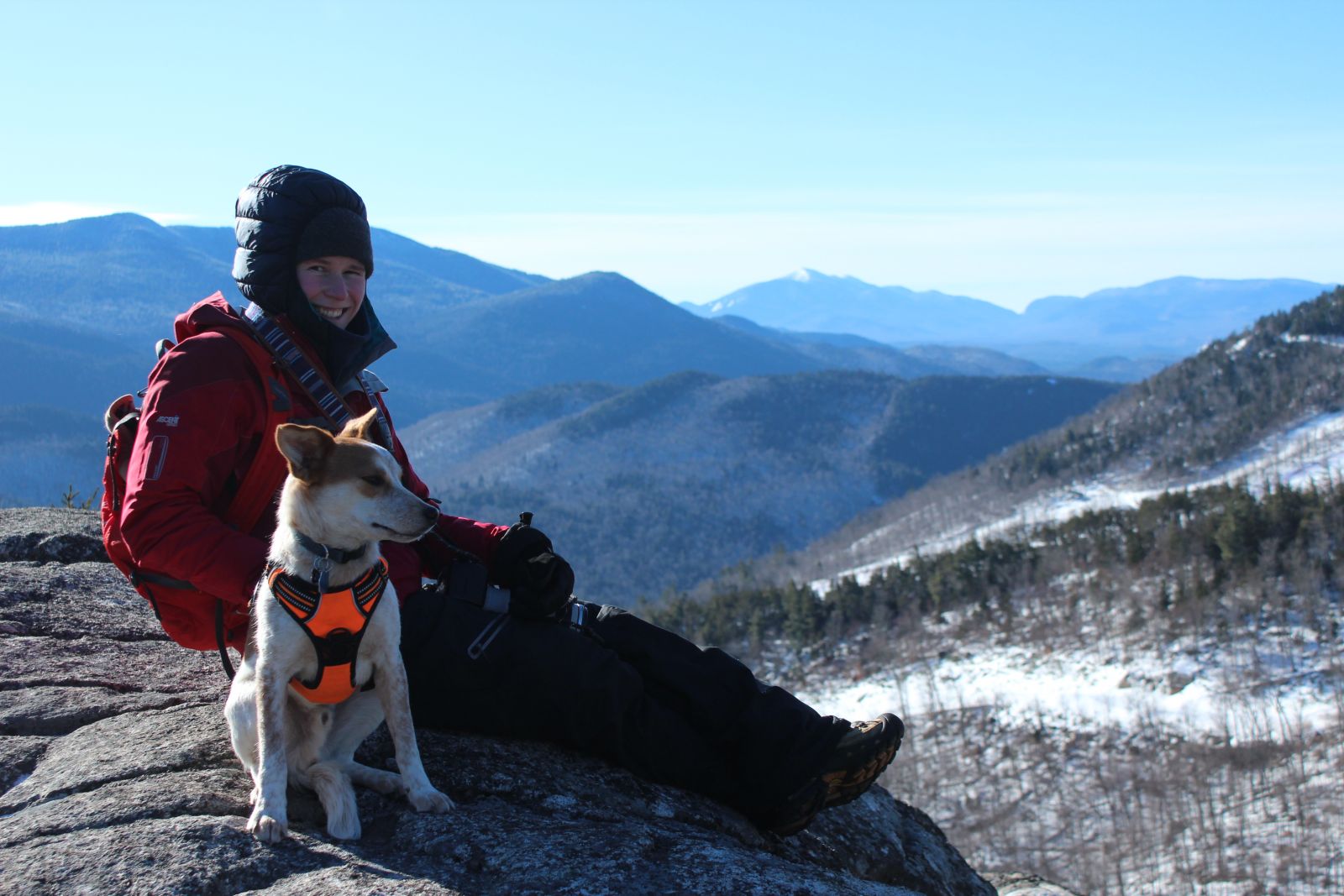
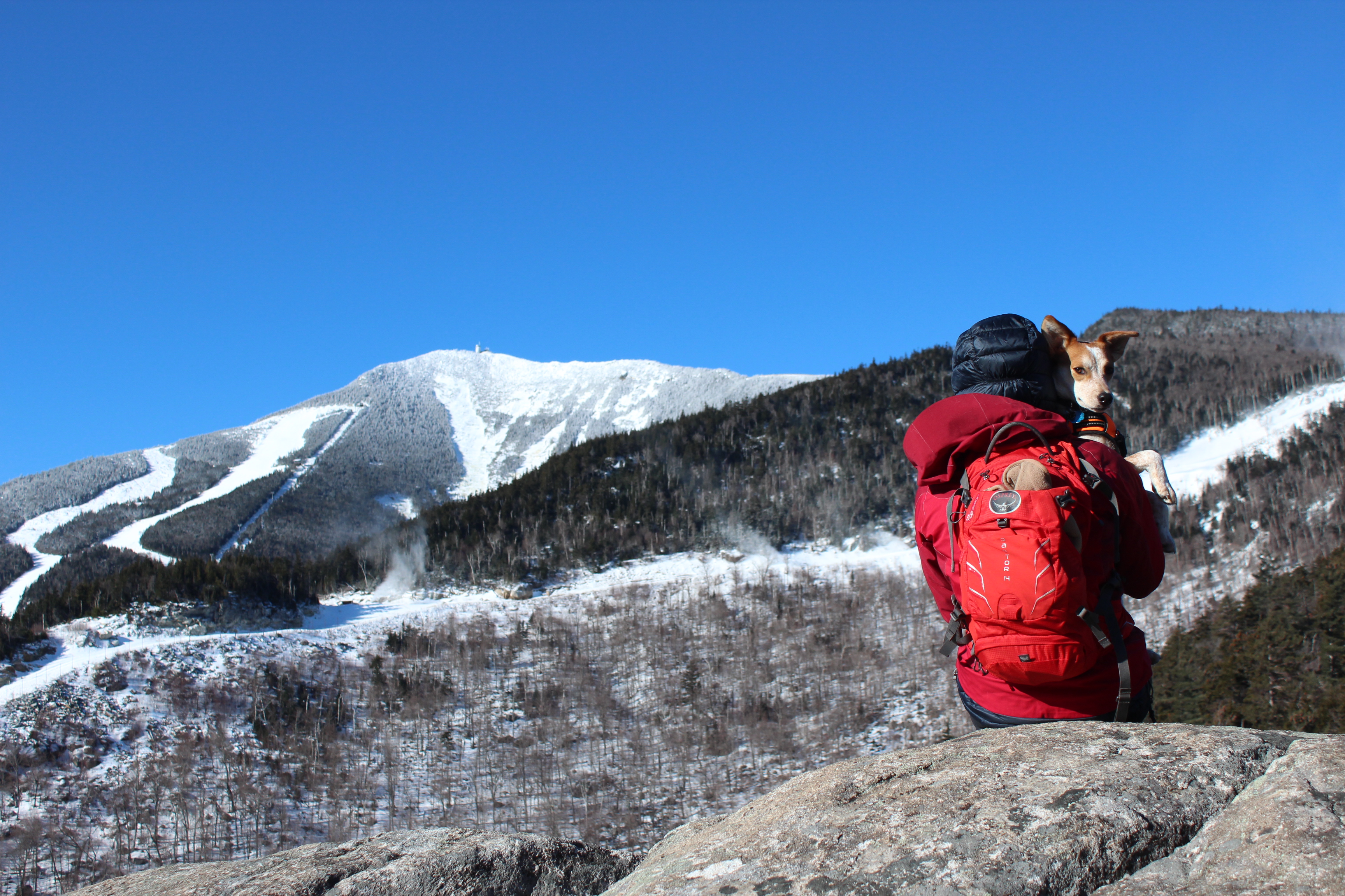
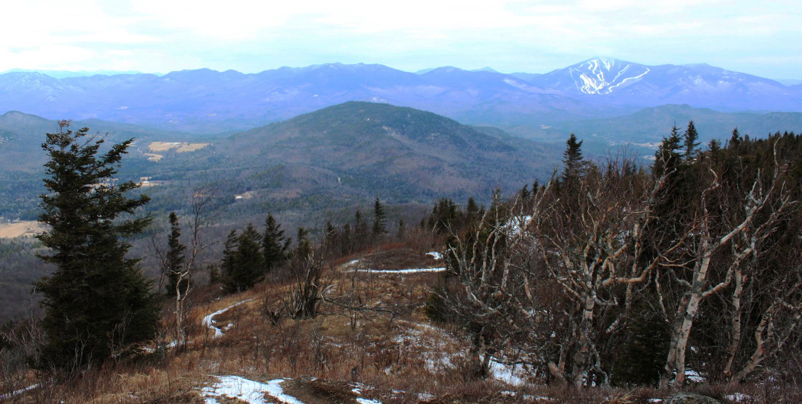
This rocky protuberance doesn’t have ski trails cut into its sides like its neighbor Whiteface, but there is a nice foot trail to the top. It climbs away from the parking lot at a gentle grade and gradually swings left, then it begins to ascend more steeply. In winter, Bear Den's impressive cliffs can easily be seen through the trees.
About halfway up the path swings left to switchback up a steep hill, then heads straight toward Bear Den. Turning right to avoid the cliffs, the trail climbs away from a pretty mountain brook at a moderate grade before beginning a series of broad switchbacks that end in the saddle between two pronounced bumps. Bearing left, the path quickly emerges onto open rock, where there are fantastic views of Whiteface, the Sentinel Range, and Algonquin Mountain in the distance.
Vital stats
Black bear (Ursus americanus)
- Weight: 300 pounds on average, but they can reach 600 pounds
- Lifespan: About 30 years
- Diet: These omnivores love to forage and will consume plants, fruits, nuts, insects, honey, salmon, small mammals, carrion, and spawning salmon.
Bear Den Mountain
- Trailhead: Pull into the Whiteface Mountain Ski Center, cross the bridge, then turn right and follow the road to the Bear Den Parking Lot. The trailhead is on the left.
- Distance: 1.6 miles to the top
- Elevation: 2,650 feet
2. Up and away like a blue jay: Jay Mountain
As soon as you learn what a blue jay’s call sounds like, you’ll always recognize it. The shrill note cuts through the forest and is reminiscent of a bird of prey. Since they’re ground foragers, it’s not uncommon to see a brilliant flash of blue erupt from the forest floor while hiking.
The path up Jay Mountain begins at a fairly easy grade and never gets too steep as it snakes its way up the mountain. The back-and-forth approach to trail design accomplishes two things: It reduces trail erosion and makes steep slopes easier for hikers to tackle.
The highlight of this hike comes at the 2.5-mile mark, where the trail ascends a steep knob to reveal an outstanding view that includes the High Peaks, Whiteface Mountain, and the rest of the Jay Range. This is a fine spot to turn around, but more adventurous hikers can continue along the mostly-open ridge for another 1.5 miles to Jay’s rocky summit.
Vital stats
Blue jay (Cyanocitta cristata)
- Weight: About 3.5 ounces
- Lifespan: 7 years in the wild, more than 25 years in captivity
- Diet: Omnivorous ground feeders, these birds eat insects, seeds, nuts.

Jay Mountain
- Trailhead: From the four-way intersection in Wilmington follow Route 86 toward Jay. Turn right on Route 9N, then turn left on County Road 85, just south of the Ausable River bridge. The trailhead is on the left after about 6 miles.
- Distance: 2.5 miles to the ridge, 4 miles to the summit
- Elevation: 3,600 feet
- Ascent: 2,250 feet
3. Fierce and elusive like a wildcat: Catamount Mountain
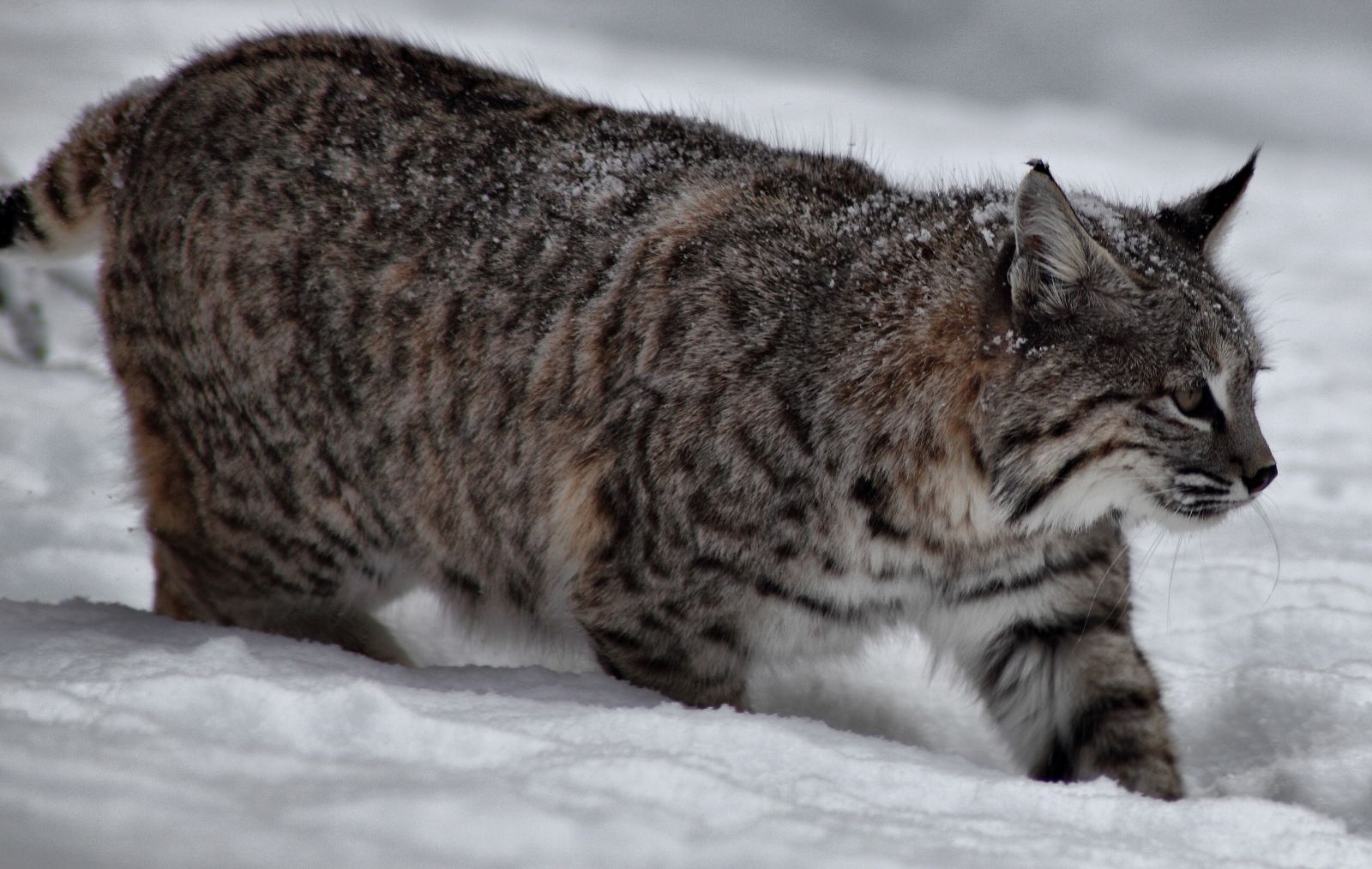
There are ongoing debates about whether or not mountain lions live, or have ever lived, in the Adirondacks. We’re not going to solve that quandary today, but what is certain is the woods here are home to bobcats. These squat, tough-looking creatures are rarely seen in the flesh, but there are enough tracks, fur, and scat samples to leave no doubt that they’re around. In fact, it’s easy to imagine them prowling the many nooks and crags found along the upper reaches of Catamount, a peak that packs a lot of excitement into a relatively short trek.
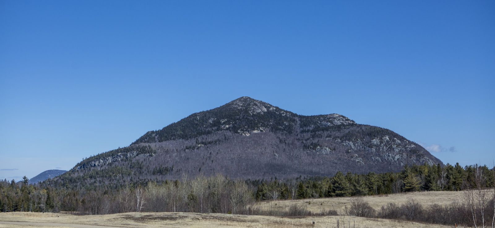
When I first learned about Catamount 10 years ago I drove right past the trailhead, which was only marked by a piece of plastic tied around a tree on the side of the road. Once I found it the path was easy enough to follow, and it still is. From the new parking lot, which is complete with a large, wooden DEC sign, the trail heads straight into the woods, passing through some interesting lichen-carpeted areas before swinging right to begin climbing through a forest that’s mostly hardwoods. Things keep getting steeper, then the forest opens to reveal a massive bulk of rock that’s intersected by a narrow crack. Go straight up that crack, then head left to continue straight up the smaller of the mountain’s two summits. You’ll weave around boulders and negotiate small ledges as you climb. Thanks to a forest fire, there are views everywhere. Take them in, but be careful — the open nature of this mountain means it's extra important to watch your footing, especially in winter, when wearing crampons is highly recommended.
Once on the first summit another hump of rock looms above, beckoning. While the vista from the lower perch is incredible, it only gets better with effort. Continue for a steep 0.3 mile to reach it.
Vital stats
Bobcat (Lynx rufus)
- Weight: Up to 30 pounds
- Lifespan: About 10 years in the wild, 25 years in captivity
- Diet: A diehard carnivore, bobcats eat rabbits, mice, squirrels, and birds.
Catamount Mountain
- Trailhead: From the four-corner intersection in the village of Wilmington head west up Route 431. At the intersections for the Whiteface Memorial Highway, just before the toll house, bear right toward Franklin Falls on Gillespie Drive. Continue for 3.3 miles and turn right on Roseman Road, then turn right onto Plank Road after 0.8 mile. The parking area is on the left after about 2 miles.
- Distance: 1.8 miles to the summit
- Elevation: 3,168 feet
- Elevation gain: 1,542 feet
Warm up in the Whiteface Region with hot food and a cold drink!
This week in ADK news: