

With the seemingly endless number of mountains within a half-hour reach of the Wilmington and Whiteface Region, how is one to choose which peak to “rock” out on. Well, unfortunately I don’t have an answer for you that is written in “stone.” However, if you are in the area and in a quandary for your next “erratic” adventure here is a couple “nuggets” you might find “hard” to resist. One of the following is an easy “pebble” of a summit, one for which most any part of your family can enjoy. The other might be considered a “boulder” as its summit is a bit harder to reach. So, now that you have something to “gravel” over, here you go.

The Pebble
Also known as Cobble Lookout this 1.1-mile family friendly hike is all the hype. Not all that new in existence it is somewhat new as far as marked and designated trails are concerned. You can find this trail by following the Whiteface Memorial Highway to Gillespie Drive. Take the right on Gillespie Drive and the trail is 0.2-miles up on the right. The initial portion of this trail has been used most often by rock and ice climbers using the quarry, yet another neat rock feature of this hike. This was the location where stones were collected during the construction of the Whiteface Memorial Highway, remnants of the labor camp are still scattered about.

This trail will bring you over foot bridges, through a hardwood forest, along gentle rolling hills to an outstanding rocky overlook. From here you can look far east into the Jay Range and right across the way to Esther Mountain as it towers over you, making you look very pebble like as well. Be sure to explore around the summit area for additional interesting views and of course scramble atop the small boulder balanced near the edge for a unique selfie or photographic opportunity.
The Boulder
Best known as Jay Mountain, Jay Ridge, Jay Range, you take your pick, it’s the same place with the same incredible payoff. You won’t be lacking for rocky outcroppings and views on this gem, I guarantee that. You can find this trailhead in none other than Jay. Follow Route 86 toward Jay and in Jay take a right onto Route 9N and continue into Upper Jay and then a left onto Trumbulls Road for 2.5 miles where it becomes Jay Mt. Rd., which is then followed another 0.8 mi to Upland Meadows Rd. I know it sounds like a long drive but it doesn’t take that long at all to reach this popular trailhead.

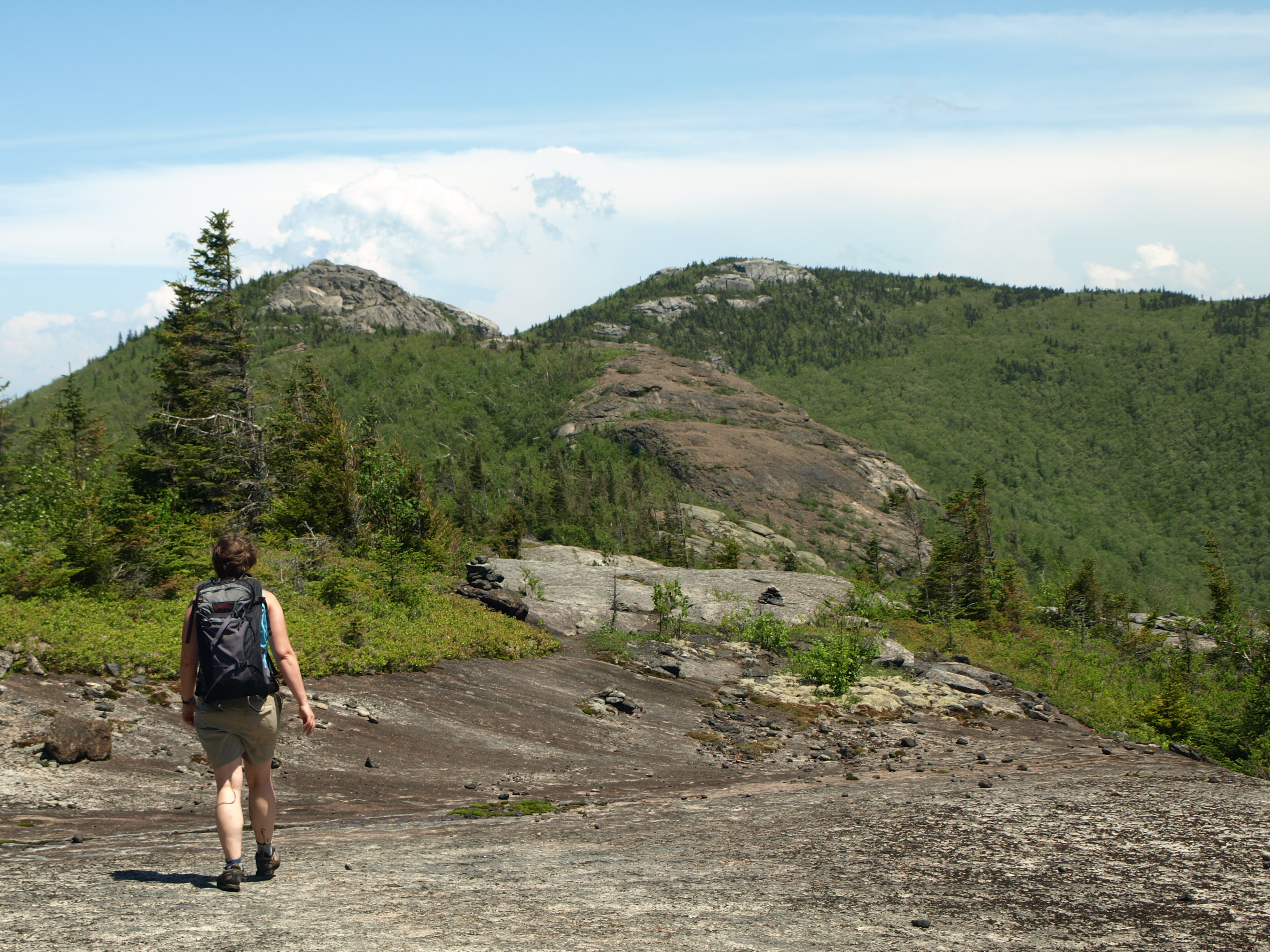
Jay Mountain has been a hiking gem for as long as I can remember but up to recent years it was simply more of an unmarked path rather than an official trail. This peak has now been opened up to a marked course through an utmost amazing forest of changing cover types to a ridge that has been considered a “rocky bridge” in the sky. Jay Mountain is broken up into two distinct summits which are connected by a rocky trail and views too numerous to count. However, if you don’t want to extended hike of the entire ridge, you can stop at the first viewing area along the ridge and you will still feel as though you have accomplished something and been rewarded for your efforts.

The trail starts out moderate and soon becomes much steeper as you work your way closer to the ridgeline. At 2.5 miles you will come to the first view from the ridge. From here it’s a hair under 1.5 miles along the ridge to the Jay Benchmark on the far end, marking the highest point of the mountain. Along the ridge you will need to traverse several smaller rocky summits, some of which are very steep and a bit of scrambling will be needed. Remember, that your return trip will also require the traverse of the same summits, so save to energy for the return leg.
